I hope you can come to the Climate Adaptation Center (CAC) Florida Climate Forecast Conference at the University of South Florida’s Selby Auditorium on November 19. Please forward this message and link to anyone who might be interested. https://www.theclimateadaptationcenter.org
A highly qualified panel of experts will discuss issues of immense importance for those of us who live on Florida’s west coast, from Tampa to Orlando and then south to Key West:
· Hurricanes: How often and how dangerous?
· Sea level rise: How much and how quickly?
· Red tide: Will it become a new normal?
· Seasonal temperatures: What will day and night temperature trends look like?
· Unlikely but high-impact events: Are the risks of extreme events increasing?
· Economics: What financial risks and opportunities does climate change pose?
In the morning, climate forecasts for the region will be discussed for 2030, 2040, and 2050, along with economic impacts. Opportunities for governments, businesses, and academic institutions to collaborate, mitigate, and adapt will be a key focus of the afternoon, along with the role of the financial industry in driving the unprecedented levels of investment required to address challenges in an era of rapid climate change. The forecasts and the conference itself offer a model for information sharing, dialogue, and collaboration that can be replicated in other regions.
Tickets for the 2021 Climate Conference are available to the public on a first-come, first-served basis. The ticket price of $65 covers all the sessions, a continental breakfast, a catered lunch on the USF patio, and refreshments. Membership in the Climate Adaptation Center is not required to attend the conference but is suggested. Here’s a link for more information about the conference agenda, speakers, panelists, and registration: https://www.theclimateadaptationcenter.org/product/2021-florida-climate-forecast-conference-2/.
Hurricanes are now stronger than ever, and Bob Bunting, president of the Climate Adaptation Center, is an expert in them. He has flown into them on airplanes; he has taught meteorology and the physics of hurricanes; and he has previously delivered lectures in the Selby Auditorium about them. He will deliver the climate change forecasts at the conference and discuss what we can expect during future hurricane seasons.
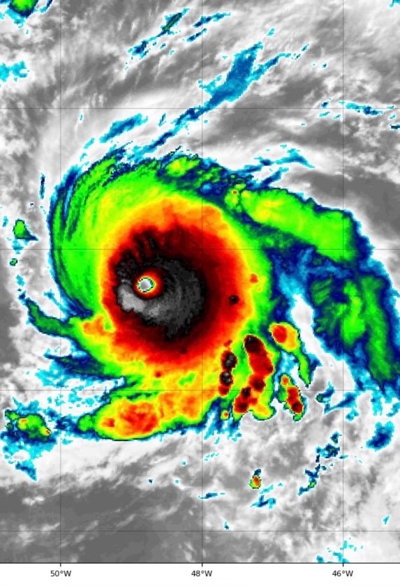
Here is the pinhole-sized, perfectly formed eye of Hurricane Sam, which did not hit us.
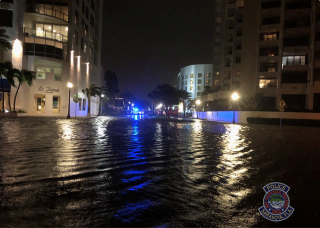
Below are two other photographs which might also be of interest. The first one was taken at 11:00 o’clock at night in November, when the storm ETA was impacting Sarasota, Florida (it made Florida landfall early November 12, 2020). A week before visiting our state, Hurricane Eta slammed into Nicaragua at Category 4 intensity with catastrophic flooding in parts of Central America. This picture is downtown Sarasota within a block and a half of my office; and if you look closely on the right, you will see the Art Ovation Hotel. Those who have visited Sarasota will know exactly where the location is. This was a three-foot storm surge. It was originally forecast to be an eight-foot surge, but the storm wobbled fifty miles, reducing the surge. Snowbirds and others didn’t witness this scene because they aren’t here at 11:00 o’clock at night in early November.
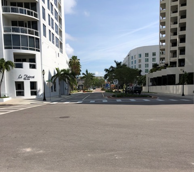
Here’s a photograph I took with my iPhone from the same location on a sunny day in May. You can see, looking at the two photographs, that I tried to replicate the angle that you saw in the first one.
Another phenomenon intensified by climate warming is, of course, red tide. Red tide is back on the west coast of Florida. Here’s a photograph and recent headline from the Herald Tribune:
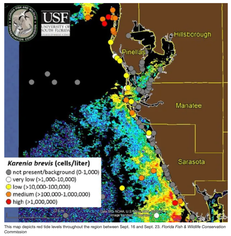
(“Red tide levels grow in Sarasota and Manatee counties,” https://www.heraldtribune.com/story/news/local/manatee/2021/09/29/red-tide-levels-increase-again-sarasota-and-manatee-counties/5913298001/)
Cumberland Advisors is pleased to be one of the sponsors of the Climate Adaptation Center Conference. The event will be filled with information, forecast data, and an assessment of where we are in the process of climate change and what to do about it.
Please come.
David R. Kotok
Chairman of the Board & Chief Investment Officer
Email | Bio
Cumberland Advisors Market Commentaries offer insights and analysis on upcoming, important economic issues that potentially impact global financial markets. Our team shares their thinking on global economic developments, market news and other factors that often influence investment opportunities and strategies.